Welcome to the
Central Algoma Adventure Map

Places, like their human inhabitants, are unique. The combination of hills, forests, farm fields, freshwater lakes and cascading rivers—and all the lifeforms and seasonal changes that go along with them—attract visitors, inspire residents, and enrich life. Sense of place encourages people, even those living in some of the most wondrous places on the planet, to interact with their local environment.
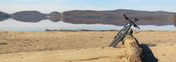
That was the goal as we took inventory of outdoor adventure in Central Algoma. This months-long activity brought back wonderful memories of cycling, paddling, birdwatching and snowshoeing—and produced a very cluttered map (we’ve pared it down to capture the best routes and trails). Longtime residents of the rural landscape stretching along Lake Huron’s North Channel from Sault Ste. Marie to Iron Bridge expressed awe, unaware of the multitude of year-round adventures so close to home. We’re excited to share these treasures because in experiencing them, we’re sure you too will feel a deeper connection to Central Algoma.
At a time when the world faces immense environmental challenges like climate change, an extinction crisis, pollution and invasive species, we hope you will also become aware of your footprints on the land, discovering that how we treat our place on the planet is how we treat ourselves. Ultimately, a passion for Central Algoma calls us to be good stewards and ancestors, leaving this place better than we found it for generations to come.
Bob Kellum and Chuck Miller
Bruce Mines
You’ll find several restaurants, a grocery store and accommodations in Bruce Mines. This historic mining town on Lake Huron is your point of departure for coastal paddling and cycling routes on back roads to quaint hamlets like Bruce Station and Rydal Bank. Bruce Mines includes heritage buildings, a walking trail, museum, swimming at Jack’s Island Beach, and a waterfront park.
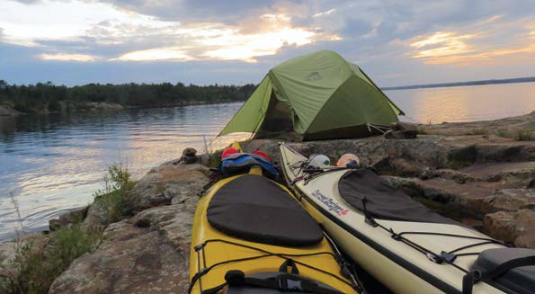
 Kayakers can launch directly from Bruce Mines to access the open water and islands of Lake Huron’s North Channel. Canoeists can launch at Old Mill Beach Park on Rock Lake, located north of Rydal Bank, off of Highway 638. This is an excellent spot to paddle in the spring and fall, with migrating waterfowl like Scaup, Goldeneye and Buffleheads in the wetlands of the Thessalon River Delta Conservation Reserve.
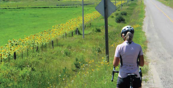
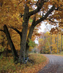
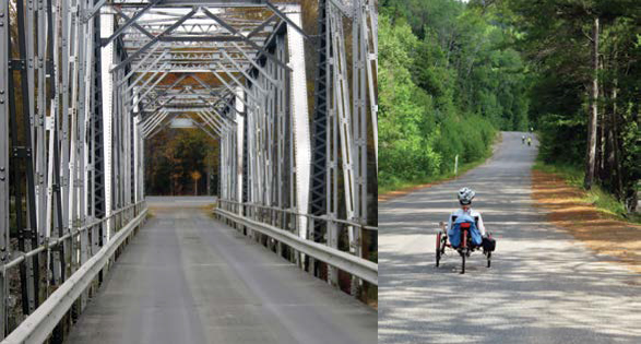
 Cycling: Starting at Rydal Bank Park, north of Bruce Mines, ride the rolling hills of Highway 638, which are especially stunning in autumn. After a rest at Old Mill Beach Park on Rock Lake, complete the 35-km circuit with easy downhills on Centre Line and Plummer roads.

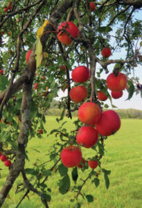
 Healthy soil is the reason Algoma’s farm-fresh foods like tomatoes, carrots and corn taste great. Local farmers protect soils by rotating crops, minimizing compaction by tilling with horses, and applying natural fertilizers like manure. Small farms provide better living conditions for livestock (producing quality meats) and ensure that surrounding trees, shrubs and wildflowers provide habitat for pollinators.
Laid Township

Point of Departure: Laird Township
This agricultural area consists of country roads, fields and forests, adjacent to the turquoise waters of the lower St. Mary’s River. Laird Centennial Park, located on Point Drive off of Pumpkin Point Road, is your point of departure. The park includes a small swimming area, playground and picnic area with washrooms.
Paddling: Explore the scalloped shoreline 10 km south to Neebish and Pine islands. Kayakers will find good shelter from winds; be mindful of the international border and keep to the Canadian (eastern) shore.

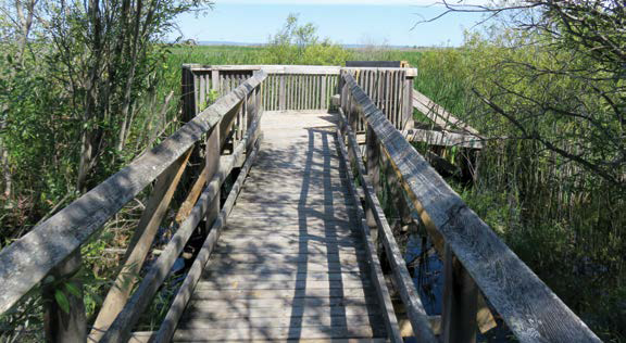
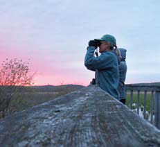 Birding:The Sault Naturalists’ bird-viewing platform on Pumpkin Point Road overlooks a vast wetland. Look for Black Terns (a graceful flier with dagger-like wings whose population has decreased by 90 percent due to habitat loss), Bitterns, rail species, and many songbirds. Over 200 bird species have been documented at this junction of aquatic, grassland and forest habitats.
Coastal Wetlands are prominent along the St. Mary’s River and Lake Huron in Central Algoma. Elsewhere, nearly 70 percent of these areas of marshy shallows have been lost to development. Coastal wetlands provide critical habitat for fish, birds, wildlife and plants—along with ecosystem services essential for humans, such as filtering pollutants from freshwater, protecting shorelines from erosion and flooding, and supporting recreation like fishing and photography.
Echo Bay
Point of Departure: Echo Bay
 The Loon Dollar Monument on Highway 17B, which celebrates local artist Robert R. Carmichael’s design on Canada’s one-dollar coin, is your Echo Bay point of departure. This wheelchair-accessible site includes parking, picnic tables, barrier-free boardwalks, and a bird-viewing platform on nearby Lake Street.
Cycling: The 42-km ride from Echo Bay to Laird Centennial
Park combines quiet, hard surface roads with great birding. In June, watch for Bobolinks, a medium-sized, threatened songbird with black plumage and distinctive white backs and yellow collars, in grassy fields, and waterfowl and Osprey along the shore. Sandhill Cranes are common in the fall—identifiable by their prehistoric appearance and low-pitched, karoo calls.

 Hiking and Snowshoeing: Drive Highway 638 from Echo Bay to Tower Lake Park, off of Lonely Lake Road, for access to a hike (or snowshoe) through hemlocks and maples on the Voyageur Trail. The swimming and picnic area at Tower Lake is also a good rest spot for cyclists.
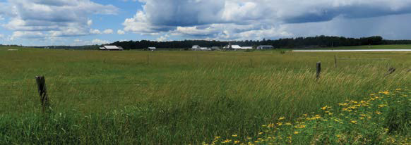
A sea of grass just south of Echo Bay is an ancient lakebed, remnant of the Ice Age. Grasslands and hayfields capture silt and mitigate erosion during rainfall and floods, protecting the soil and water quality. This landscape is essential habitat for Eastern Meadowlark, an insect-eating songbird with a flashy yellow breast, and Monarch Butterflies.

Desbarats
Point of Departure: Desbarats
The village of Desbarats reflects the agricultural heritage of Central Algoma with a Farmers’ Market and vibrant traditional community, along with access to the island-dotted waters of Lake Huron’s North Channel. The Johnson Township Community Centre off of Highway 17 is your point of departure to explore this diverse area.
Paddling: Launch your kayak at the municipal boat launch on the Desbarats River, just off the Trans-Canada Highway, and paddle east towards the pink granite and wispy pines of Dawson and Portlock islands. Canoeists can explore the sheltered waters of Caribou Lake from Suddaby Park, located northeast of Desbarats off of Gordon Lake Road.
Cycling: The mostly gravel, 39-km route from Desbarats to Bruce Mines passes many traditional farms and small sawmills. Pack a picnic lunch to enjoy on the Lake Huron waterfront in Bruce Mines or treat yourself to ice cream.
The Kensington Conservancy is a non-profit land trust that protects nearly 400 ha in the Desbarats area. The organization works with landowners to acquire ecologically sensitive land to be managed as nature preserves. Visit the Kensington Conservancy Centre on Boyer Drive to access a 3.5-km network of trails in the Foster Parkland.
Richards Landing

Point of Departure: Richards Landing
Richards Landing includes a marina, grocery store, restaurants and accommodations—and a laid back vibe that embodies the friendly atmosphere of St. Joseph Island. The town is a point of departure for cyclists and paddlers; pancake breakfasts featuring local maple syrup are available at the Legion Hall in early spring.
Paddling: Women’s Institute Park includes a picnic shelter, playground, washrooms and a swimming beach with rafts. It’s also a great spot to set off on a kayaking day trip. Head west, tracing the shoreline to the Shoal Island Lighthouse and explore the spectacular Canadian Shield islands beyond.
Cycling: Long-distance road cyclists will love the challenging, 72-km circumnavigation of St. Joseph Island on Highway 548. For a shorter tour, pedal west from Richards Landing and circle back on backroads, watching for grassland birds like Bobolinks, Meadowlarks and Eastern Bluebirds in the fields along F&G Line and 10th Side Road.
Riparian areas refer to the margins between water and land, life-rich zones that provide critical food sources and shelter for wildlife and buffer against erosion. St. Joseph Island communities are collaborating to restore riverbanks on Two Tree Creek, a stewardship project that will improve water quality, increase biodiversity and mitigate erosion during floods.

Jocelyn Township
Point of Departure: Jocelyn Township
 Jocelyn Township is your point of departure to explore the southern tip of St. Joseph Island, including Fort St. Joseph National Historic Site of Canada. The rolling topography is blanketed by a mix of maple and beech trees with wetlands extending to Lake Huron. You’ll find a great public swimming and picnic area at Beech Beach. Visitors can also get a taste of one of Ontario’s biggest maple syrup producing regions, with sales of sweet treats peaking in March and April.
 Nordic Skiing and Hiking: The groomed trails of Mountainview Centennial Park on Highway 548 are home to the annual Maple Syrup Stampede cross-country ski loppet each
February. The park also features a tobogganing hill and 7 km of hiking trails for year-round use.
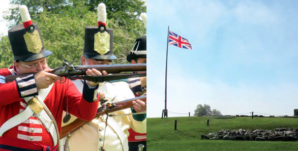
Hiking and Birding: Ghosts of the War of 1812 linger at Fort St. Joseph, the site of a strategic alliance between soldiers and First Nations warriors to defend British North America against the United States. Parks Canada delivers heritage interpretation and maintains hiking trails, including the Rains Point Trail, which is wheelchair accessible. The diverse forest, wetland and shoreline environment is home to over 100 bird species.
Invasive species pose serious threats to biodiversity and regional economies. Devastating outbreaks like parasitic Sea Lamprey in the Great Lakes and the Emerald Ash Borer often arise due to human ignorance. The beech forest of Jocelyn Township is currently threatened by a non-native insect that targets the trees’ smooth, gray bark and feeds on sap, causing death. Beech bark disease is especially prevalent in forests with greater than 50% beech trees.
Hilton Beach
Point of Departure: Hilton Beach
Hilton Beach has a marina, a general store, restaurants and accommodations. The town embraces the scenic St. Joseph Island waterfront on Lake Huron’s North Channel. It’s your point of departure for a variety of all-season adventures, with kayak launches nearby at Big Point Park and Milford Haven.
Hiking and Snowshoeing: The Kaskawan Trail was once a path for early St. Joseph Island settlers. Today, you’ll find easy hiking options in an open maple-beech forest,
starting right from Hilton Beach. Snowshoeing is also possible; watch for snowmobiles as portions of the trail are shared with motorized users.
Cycling: In autumn, ride through a tunnel of flaming maples and golden beech on Baseline Road, part of a 31-km cycling route from Hilton Beach to Big Point Park (with a beach and picnic area) and back. Forbes Community Park is another swim spot.
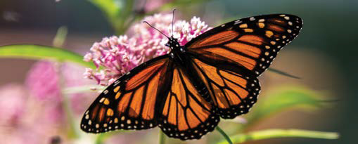
Milkweed plants are a food source for Monarch Butterflies, a pollinator species that makes amazing annual migrations. Volunteers monitor Algoma’s butterfly population and advocate for habitat protection such as delaying mowing roadside grasses. Download the iNaturalist smartphone app and make your own contribution to protecting
biodiversity and combating the global extinction crisis.
Thessalon
Point of Departure: Thessalon
Central Algoma’s largest community has a marina, shopping, restaurants and accommodations. Check out Thessalon’s summer Community Day weekend or go birdwatching on Lake Huron at Thessalon Point. Little Rapids Heritage Park, just off Highway 129, is your point of departure to discover cycling, hiking and snowshoeing in the Kirkwood Forest. The park hosts an August fair and includes historic buildings. There’s also a nearby general store.
Cycling: Ride backroads in the Municipality of Huron Shores from Little Rapids east or west, making connections to Sowerby (a mostly gravel route via Ingram and Basswood Lake roads) or Bruce Station (on the mostly hard-surface Ansonia Road). Study the map for loop options back to your starting point.
Hiking and Snowshoeing: The Voyageur Trail passes through the Kirkwood Forest, just north of Little Rapids. The tall, open pines and sandy knolls are especially alluring for backcountry skiing and snowshoeing, off the main trail.
Conservation efforts starting in the 1920s led to the recovery of fragile lands in the Kirkwood Forest, restoring abandoned agricultural lands with a managed forest of red and white pine and spruce. This sandy headwaters area north of Little Rapids drains into the Little Thessalon River, and supports a red oak and white birch forest. The Rose Lake Dunes and Peatlands and Byrnes Lake conservation reserves bookend this area.

Sowerby
Point of Departure: Sowerby
A seasonal farmers’ market and historic 12-sided barn are the main attractions in Sowerby, a hamlet in the Municipality of Huron Shores on Highway 17. Sowerby is your point of departure for paddling, hiking, snowshoeing and cycling. Before your adventure check out the Cordukes/Weber barn or visit nearby Thessalon First Nation.
Paddling: Canoeists can launch from the Roe Park picnic area on Sunset Beach Road to explore Bright Lake. Little Basswood Beach Park is another destination for canoe day trips. Both lakes feature excellent fishing. MacBeth Bay Boat Launch on Emily Court, off of Jarrett Road, 5 km west of Thessalon, provides a launch for kayakers setting out on Lake Huron.
Cycling: Ride 42 km on the Great Lakes Waterfront Trail east to Iron Bridge, following mostly gravel roads south of Bright Lake. Study the map to uncover additional side trips through this hidden agricultural area that abounds with pastoral views.
The lakes of Huron Shores are beloved by cottagers and year-round residents. Lakefront property owners play a role in preventing nutrient pollution. Maintaining native vegetation along the waterfront prevents erosion and filters pollutants. Avoiding lawn fertilizers (and lawns altogether in favour of native plants), inspecting septic systems and choosing phosphate-free soaps and cleaners also protects water quality.

Iron Bridge
Point of Departure: Iron Bridge
Located in the Municipality of Huron Shores, Iron Bridge has a grocery store, farmers’ market, restaurants and accommodations. This is your point of departure for paddling, hiking, snowshoeing, birdwatching and cycling—as well as the Deer Trail Circle Route, a scenic 120-km car tour to Elliot Lake.
Paddling: Access some of Lake Huron’s finest kayaking from Beharriell Park on Dean Lake Road. Head east to trace the chain of islands extending from the mouth of the Mississagi River or journey west to explore the Burton Islands.
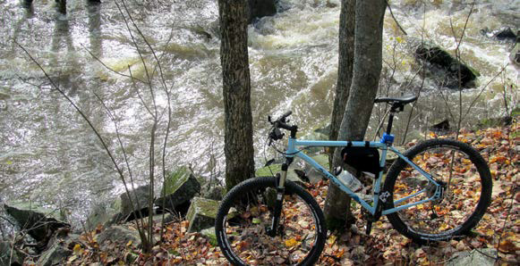
Hiking and Snowshoeing: The Voyageur Trail follows the Mississagi River valley east from Melwel Road to Tally Ho Park in Iron Bridge. This 8-km section through a mixed-wood forest features stunning views of one of Algoma’s largest waterways. Be cautious around the dam-controlled Mississagi River and stick to
the well-marked trail; water levels can change rapidly.
Protected areas are critical repositories of biological diversity. Muchof the Lake Huron shoreline between Thessalon First Nation and Blind
River falls within the North Channel Inshore and Mississagi Delta provincial parks, safeguarding wetlands and granite islands, home to a variety of birds, amphibians and larger species of wildlife—and providing excellent kayaking.